From our summit experience, we headed back down. Only 7 more miles to go! We had renewed our energies since we knew would be going downhill and then following a ridge. The trail ahead of us was daunting but we felt strong! We made our way precariously down the Table Rock Trail. We had that look I had seen in those who passed us as we trudged uphill. We looked satisfied, energized and most importantly we were not panting.
We came to the crossroads and watched as some of the familiar hikers we had seen along the way continued down. We took the road less traveled.
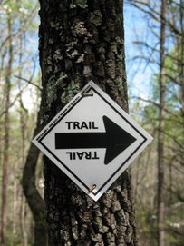
Right away we could tell it was less traveled. It was as if we entered an entirely different world. Where we had been headed on a minor hiking highway before, now the trail was more like an Indian foot path, the earth was soft beneath our feet. The weeds criss-crossed ahead of us as if to keep their well known secret. Most noticeably, the boulders disappeared, not to be seen again until much later in our hike! The ridge immediately confronted us with it's steepness. There were no rock stairways here to guide our feet, no showiness, just steep hills.
“Mom, I thought you said this was going to be flatter,” came from behind me.
We pushed our calves until they felt like concrete blocks begging us to stop. The trail would level out, we would sigh relief and then up we would go again. Finally on a level ridge, we passed a small group of hikers headed the opposite way. They asked us how much more uphill they had to go and then we knew we must be headed down. We went down into a rhododendron tunnel and enjoyed the cool, lush greenness of it. Somewhere just past the bottom of this descent was the Mill Creek Pass trail. I had already decided we were probably going to take this. The thought of one more steep climb to Pinnacle was too much for that moment. We got to the pass and I thought I would run up the Ridge trail and get the Little Brown Jug box. Surely it was fairly close by. After searching for a few tenths of a mile, I couldn't find the landmark so I returned to the fambly. 'd' and I made a decision. After looking over the map, it wasn't that much farther to get to Pinnacle's summit. Sure it was all uphill, but then it would be all downhill from there, right? We decided to go for it. We knew we would regret being that close and not doing it one day. So after eating our Power Bars we headed on up.
Our Hiking South Carolina book had warned that this part of the trail was steep, but we found it to be very do-able. We ascended to a high point, only to be greeted just around the curve in the trail, by another hill. After we ascended the third of these, we were sure we were at the top. The summits are not very well marked here. Table Rock Summit did not a marker, so we weren't expecting Pinnacle to have one. Our guide book had also warned us that the summit was tree covered, with no views. We looked around us and could not see another higher point. So we decided it was time to plant our summit box. We found just the perfect tree. A little too perfect! It looked like a bear might be setting up camp there any moment now, so we opted to hide the box behind the tree. We didn't want to risk being responsible for any letterboxer losing a limb to a grumpy bear! After this we set off with light hearts and feet, knowing that the road would be all downhill from here....
But we were wrong! We ascended a few more steep hills before we actually made it to the summit. It was too far to go back and get the box, so it still lies just short of the pinnacle of Pinnacle, oh well! If we ever make it back up there,we intend on moving it. But that will have to wait.
Now we were really headed downhill. And downhill was no joking matter. We reeled down several twisty, steep inclines just barely hanging on. It was like a roller coaster for hikers! We knew one thing for absolute sure: we were glad we had not come up this way!!
After passing the beginning of the Foothills Trail (which I left my box at home for, dangit!) we soon came to Bald Rock. Not to be confused with the Bald Rock that locals send cars over and my college friend found a dead body at! This Bald Rock has a spectacular view. Probably one of the best in all of Table Rock State Park. The sea of mountains gently rolling out of the flat lands against the late afternoon sun was comforting. We were still feeling good, knowing our big hike was nearing to an end.
We descended a little more and came to the Mill Creek Pass. This was a great resting spot and we managed to locate a hidden still, which could've made the rest of our hike painless. While we were able to find the still, it appeared that the Revenuers had confiscated the moonshine!
We enjoyed the cool river for a moment and then headed on. We were guessing we still had about three miles to go and we were ready to be back at the bottom of the mountain. When we came to Mill Creek Falls it was clear that our area is in a sever drought. Very little water trickled down the stair step rock faces. We did several river crossings on our way down. The rivers here are not the smooth pebbled mountain rivers, but wild and full of boulders and long slick rocks. I was fascinated with the sluice that channeled the entire river through a 6 inch gash in a flat rock. The water rushed through as if it was a sharp knife slicing cleanly into it.
After this we entered into forest hiking. Lots of land and boulders beginning to pop up out of nowhere. Rock walls dwelt beside the trial in harmony with the land, not imposing giants like on the Table Rock trail. This was when we began to walk with a hypnotic step. One foot in front of the other. We could've been doing it in our sleep! We were getting very tired and more than ready to be done, but there was still a mile or so to go. Our feet were aching and our legs would probably not know how to stop when we did get to the end of the trail.
When we saw Carrick Creek and then hooked up with the Carrick Creek trail we were elated. I am sure that the Carrick creek trail is beautiful in it's own right, but it was beautiful to us because it meant the end was truly in sight!
As we rejoined the paved section of the trail I reached in my pocket to get our hiking pink slip out. I placed it into the box, so the rangers would know we made it out alive. Then I headed straight for the nearby water fountain. As I greedily slurped water, 'd' elbowed me. I thought he was trying to get his turn at the fountain, so I tried to get in one last slurp. When I looked up he was pointing to the kiosk where I had dropped off our hiking slip and there were Kya and Karver Redfern! It was so good to see them. We chatted a bit and then headed on our way home...to meatball subs and Coke! Delicious!!! Maybe one of the top three meals of my life.
Total hike: 11.4 miles
Subscribe to:
Post Comments (Atom)


2 comments:
Y'all are very daring to attempt an 11 mile hike! I told FFD the same thing. You did find little brown jug though, didn't you? It seems I remember the find notice. Thanks again for a great event at an awesome location. We're just glad it's not too far away from us as we still have many boxes to find. FFD says next time he's letting y'all plant first because now to get your boxes he has to rehike the trail(or is it trial like you put in your blog).
FFQ
hello
it is really nice blog
nice topic
hope be a frinds
c u soon
bye
Post a Comment